Every Path Has a Story: Walking Oxford's Hidden History Underfoot
There's a moment that happens to most walkers eventually — usually somewhere quiet, away from the tourist trail — when you look down at the ground beneath your feet and realise you're not just crossing a field. You're following a line that people have been following for centuries. Maybe longer.
Oxford is exceptional ground for this kind of thinking. The city and its surrounding countryside hold layer upon layer of human movement — Roman engineers, medieval pilgrims, Victorian day-trippers, canal workers, and drovers — all of them worn into the landscape in ways that still shape where we walk today. For members of Oxon Walkers 2030, exploring that history has become one of the most quietly rewarding dimensions of the club's activities.
This isn't about turning every walk into a history lecture. It's about understanding that the act of walking a path connects you to every person who ever walked it before you. That's a genuinely powerful thing.
Roman Lines: The Oldest Roads in the Region
Start with the oldest layer. The Romans were, among other things, extraordinary infrastructure engineers, and Oxfordshire sits at the intersection of several major Roman routes. Akeman Street — running roughly east to west through the county — connected the Roman town of Alchester (near Bicester) to Cirencester, and significant stretches of it survive as footpaths and bridleways today.
Walking sections of Akeman Street near Wendlebury or through the fields around Chesterton, it's possible to feel the deliberate straightness of the route — that Roman insistence on the direct line, regardless of what lay in the way. The path doesn't meander the way a medieval track would. It pushes forward with the confidence of an empire.
The Oxon Walkers 2030 route through the villages north-east of Oxford passes close to the site of Alchester itself. There's nothing dramatic to see at ground level — the archaeology sits beneath ploughed fields — but knowing it's there changes the quality of the walk entirely.
The Thames: Oxford's Original Highway
Long before roads made overland travel reliable, water was the easiest way to move people and goods. The Thames through Oxford wasn't primarily a leisure route — it was a working artery, carrying stone, wool, grain, and people across the country.
The Thames Path through Oxford and its immediate surroundings is one of the most historically dense walks in the region. At Iffley Lock, you're standing next to one of the earliest pound locks in England, a piece of engineering from the 1630s that transformed commercial navigation on the river. The Norman church at Iffley itself — a short detour from the path — is one of the finest examples of Romanesque architecture in the country, and it sits here precisely because this was an important crossing point.
Heading upstream towards Abingdon, the path passes the site of Andersey Island, where the Saxon town of Abingdon first developed around its great monastery. The monastery is long gone, but the curve of the river that shaped the settlement remains exactly as it was. Walking it, you're following the same line that monks and merchants walked a thousand years ago.
Medieval Tracks and Market Routes
The medieval period left a different kind of mark on Oxfordshire's paths. Where Roman roads were engineered, medieval routes were organic — worn into existence by repeated use, connecting villages to markets, churches, and each other.
The Ridgeway, which passes through the northern edge of the county before climbing onto the Berkshire Downs, is one of the oldest continuously used routes in Britain. Some archaeologists argue that people have been walking this high chalk ridge for five thousand years. Whether or not you accept that figure, the Ridgeway's age is legible in the landscape: the path sits between ancient field boundaries, passes Bronze Age barrows, and skirts hill forts like Uffington Castle with the ease of something that has always been there.
Closer to Oxford, the network of paths connecting the villages of the Cherwell Valley follows routes that were established to serve medieval agricultural communities. These weren't leisure paths — they were working connections between farms, mills, and market towns. Walking them today, you pass through the same field layouts, cross the same streams, and navigate the same gentle gradients that generations of farm workers would have known intimately.
Industrial Heritage: The Canal Towpaths
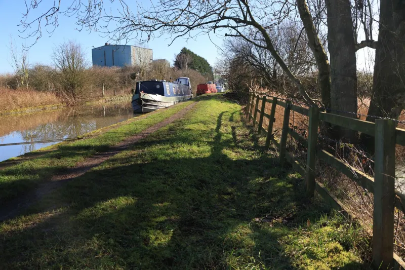
By the late eighteenth century, Oxford had become a key node in Britain's expanding canal network. The Oxford Canal, completed in 1790, connected the city to the Midlands coalfields and transformed the economics of fuel and goods supply. The towpaths built for the horses that pulled the canal boats are now some of the most pleasant walking in the county.
The stretch of towpath north from Oxford towards Thrupp and Enslow is a particular favourite among club members. It's flat, well-surfaced, and passes through a sequence of settlements that grew up specifically to service the canal trade — the old wharves, the lock-keeper's cottages, the canal-side pubs that fed and watered the boatmen. At Thrupp, the line of working boats moored along the bank is a direct continuation of that two-hundred-year-old tradition.
"I've done that towpath walk probably thirty times," says Janet, a long-standing Oxon Walkers 2030 member. "But once someone pointed out what the old wharf buildings actually were, I started seeing the whole thing differently. It's not just a nice canal path — it's a working-class industrial landscape."
Victorian Leisure and the Birth of the Walking Culture
There's a pleasing circularity in the fact that Victorian Oxfordians helped invent recreational walking as we know it. The university's influence meant that Oxford had a particularly high concentration of educated, physically active people who valued outdoor exercise — and the network of footpaths around the city was extensively used and written about from the mid-nineteenth century onwards.
Christ Church Meadow, Port Meadow, and the network of paths through Wytham Woods were all part of this Victorian leisure geography. Port Meadow in particular — a stretch of common land that has never been ploughed — is a direct link to a pre-industrial landscape, and the Victorians walked it for the same reasons we do: the light on the water, the open sky, the sense of escape from urban noise.
Walking as Archaeology
You don't need specialist knowledge to walk Oxford's history. The paths are there, and the stories are accessible to anyone who's curious enough to look them up before setting out. A quick read of the Oxfordshire Historic Environment Record, or even a half-hour with a good OS map and a local history book, transforms an ordinary walk into something richer.
The Oxon Walkers 2030 programme includes several historically themed group walks each year — routes designed specifically to connect the physical experience of walking with the layers of human activity beneath your feet. If you haven't joined one yet, they're worth your time. There's something about walking the same ground that changes how history feels — less like information, more like memory.
Check the club calendar for upcoming heritage walks, or suggest a historical route in the forum. We're always looking for members with local knowledge to help shape new itineraries.